
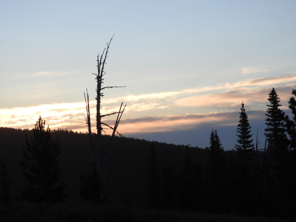
After the clockwise 4 day Timberline Trail from 2020, planning another trip after recent nobo and sobo approaches to Mt Hood, counterclockwise was the plan with 2 bonus side-trips, Cooper Spur and McNeil Point or Paradise Park. 3 days /2 nights were allocated and counterclockwise worked best based on my hiking distances, stream crossing and drinking water. Making it even better was the Fall Equinox. Thanks to help from my guitar-playing buddy, getting to Mt Hood Timberline Lodge to start the Timberline Trail at sunrise was a quick 90 minute drive.
At the lodge, parking was a pain – the lot was empty, but there were signs about overnight parking only were posted – i could only find posts of where NOT to park – parked in the middle; asked parking guy upon return, and he said park on far east edge.
Day 1 – Timberline lodge to Cloud Cap – + up Cooper Spur
Starting off on the PCT at sunrise toward the TImberline Tr junction was perfect, almost …

In the lower right pic, the sand blowing in the wind shows up – it was so strong that I had to put my Buff over my face – sandblaster!
Once on Timberline Tr, its around Mt Hood Meadows with clear skies, flowers and waterfalls.


From the meadows, over Clark Creek and on to Newton Creek. Newton Creek crossing caused the greatest stream delay as the lodge side trail was re-routed and getting to the trail on the other side was a challenge for me (i had not placed the exit on GPS). Crossing the creek (like all the creeks this time) was a simple rock hop.
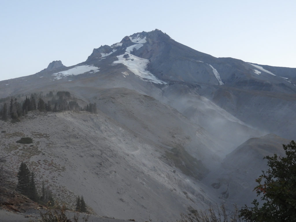
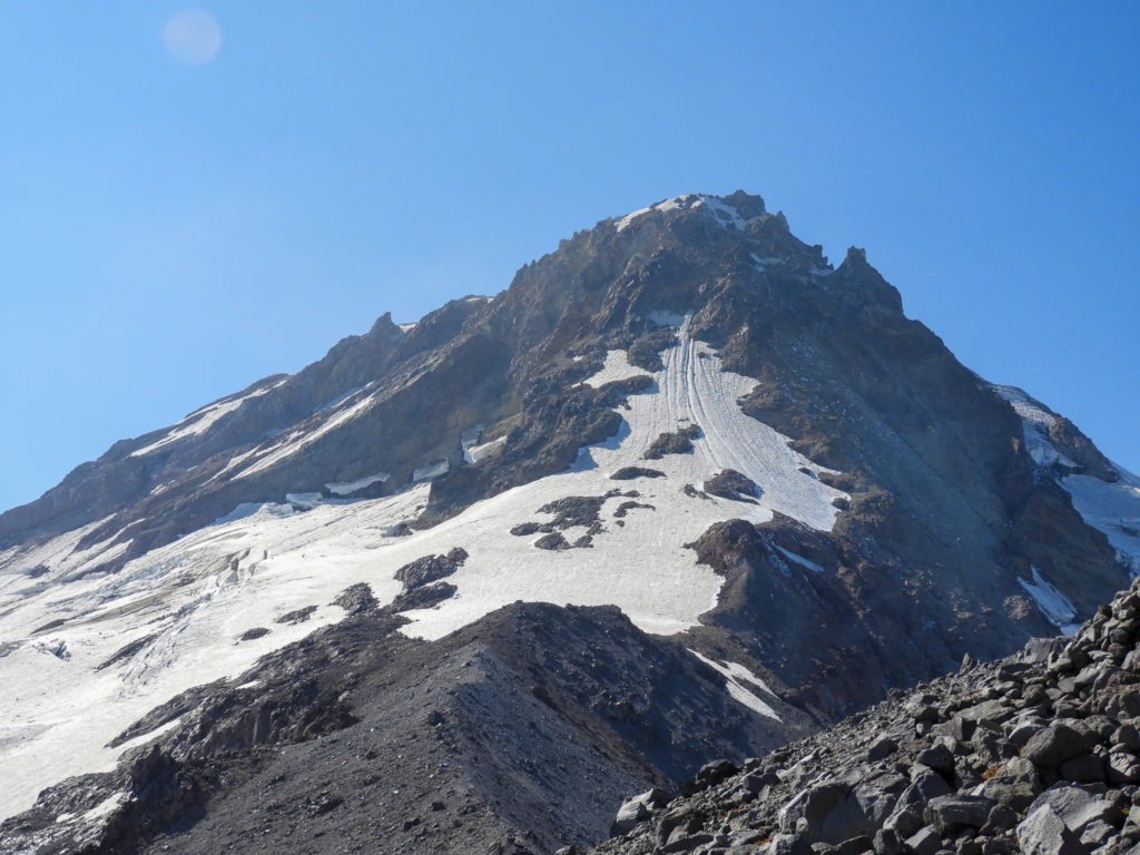
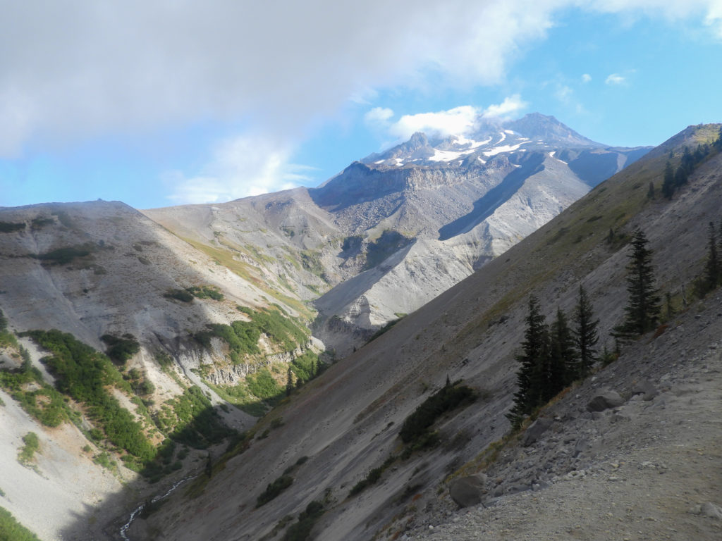
Gnarl Ridge this direction is a climb, but all worth it as at the top a view of Mt Hood and Cooper Spur destination. There is little, if any, water going up the ridge – be prepared! On the way, the only snow field to cross was about 3 ft.


Up Cooper Spur is not for the feint of heart … I ended above 8600 ft elevation much higher than 2020. The shelter is a well-known way-mark, and Elliot Glacier is the key feature off the right (south/west). From top left to right – Shelter, Elliot Glacier, looking up Cooper Spur, and finally looking down (on the way down)


Part of this trail goes very close to Elliot Glacier; the last time there, the glacier was breaking, birthing smaller pieces into Elliot Creek. This time, all was quiet
The gallery was not found!It was down to Cloud Cap campground for the night – running water, 4 cars, 6 tents and a wonder 6000 elevation view back up the mountain. (the left shoulder, spur is Cooper Spur and I traveled up to the last bump w/out ice.

Day 2 – Cloud Cap to Paradise Park, via PCT
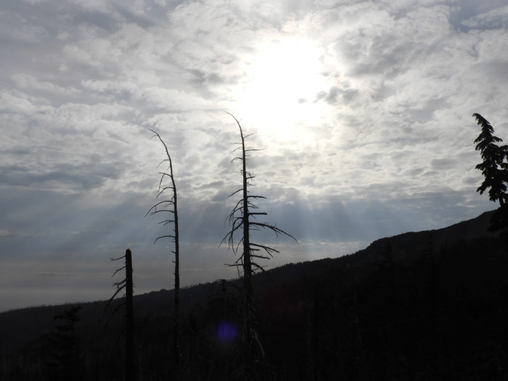
Sunrise on the ‘high mile’ day was spectacular … especially after a short 5 minute rain / snow around midnight.
The gallery was not found!Elliot Creek was crossed before 7:00 with 3 rock hops; the hardest part was getting to and from the creek. Coe Creek was the same. Further around, this stream in July flows THROUGH the ice … in September, the ice is too small. A view back up the hill shows the new snow.


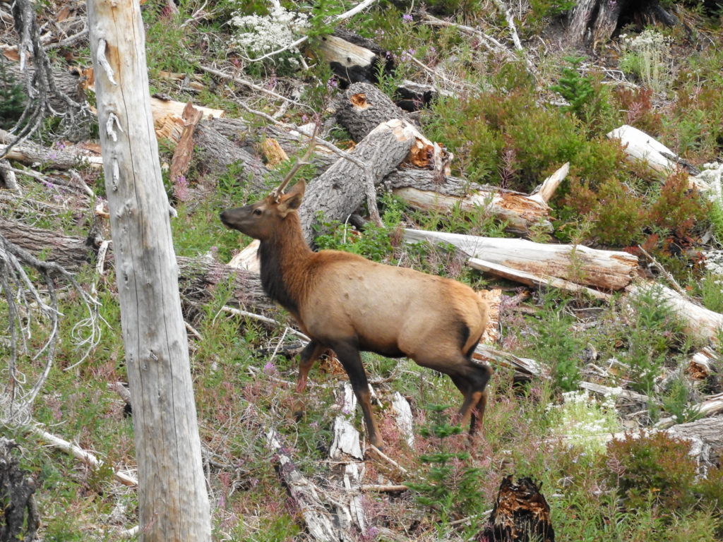
Continuing around above Elk Cove, a couple of residents made their presence known. This was a first for me in Cascades and surprisingly they are NOT quiet running through the burn – sounded like a truck in the undergrowth.

Elk Cove is one of those places – there were several tents scattered around – the views up even under overcast skies were breathtaking.


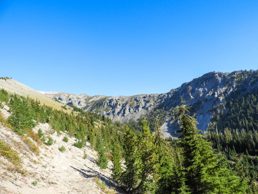
Continuing around through Cairn Basin (magical spot) and around the “Bear Grass Ponds” dry in September …


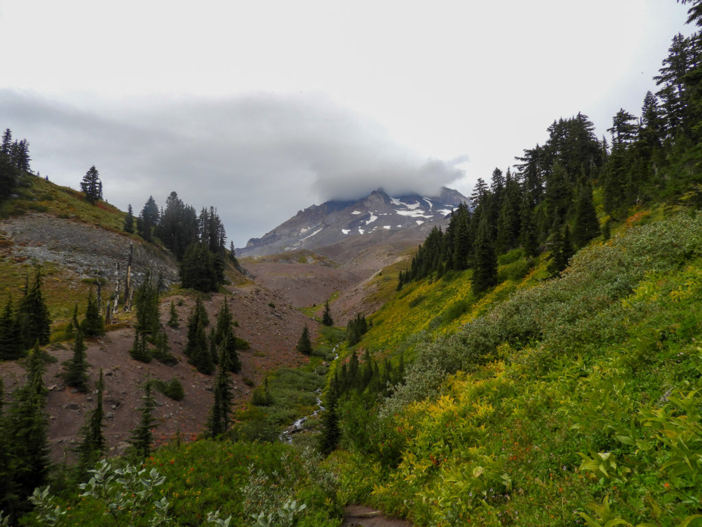
Between Cairn Basin and Paradise Park, it was down to the Sandy River (a very, very long descent) and then back up from the Sandy River (just as long) passing Ramona Falls on the PCT this year. It rained off / on all afternoon, and my Gortex jacket was worn. The underbrush was very wet and I got wet too! Not from crossing streams, but walking in the grass :).
Once at Paradise Park, looking for a good campsite I ran into another hiker who pointed me to a site I remember but had forgotten. I set up camp anticipating rain, and it rained lightly until around 11pm, and cold. I ate breakfast in tent under tarp. Paradise Park is just a fab place to camp, and my campsite was the best one all summer! All evening, the clouds and Mt Hood danced.


Day 3 – Paradise Park to Timberline Lodge + up Paradise Park
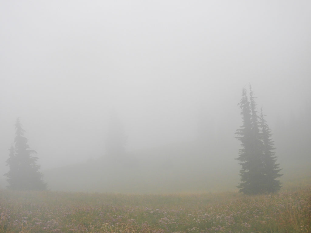
A cloudy, foggy day dawned and before heading toward the Lodge, it was up Paradise Park trail. There are three phases of this trail: underbrush, low heather and then cinders / boulders. Here was the start in the undergrowth – which was very wet.


Then, through the heather and onto the cinders visibility went to almost 25 feet due to the fog. The wind was howling and it was cold! Once again, the Buff was around my face but this time to keep warm.

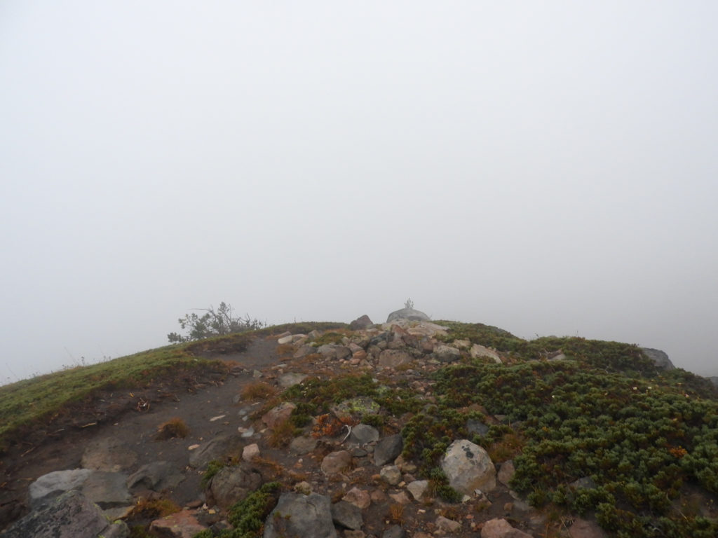


Once the trail became too hard to follow in the fog, I turned around and went back down. At the junction of the Paradise Park Loop trail, visibility was same.
Back down to the PCT and around down and up the Zig Zag River Canyon with the sun trying its best to break out.

By the time back at the Lodge, the wind was howling again, it was below 40 degrees, and it was time to head home.


Summary: Timberline is one of those trails – it is NOT easy. It is NOT for first-time backpackers. It is best done with somebody who’s gone before. With that said, September is WAAAAY easier than July / August – mostly for the stream crossings. This time, every stream was a rock hop with the hardest part getting to / from the creeks. Too many people to count every day – loopers and day hikers. Too many dogs and only 1 on a leash. 1 person with a gun. The trail is in tip-top shape the best in 3 years. It’s hard to pick a favorite section as they are all fabulous … this was the 2nd time around both cl and ccl, and the 4-5 time on the northwestern section (Cairn Basin to Ramona Falls). The weather was a tad challenging – Buff was needed on face at start (wind and sand) and at Paradise Park (cold), and some drizzle.
I’d go back and do in September next if anybody is interested … and given my hiking style (starting very early) counter-clock-wise (CCL) is the way to go.
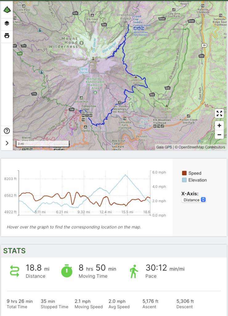
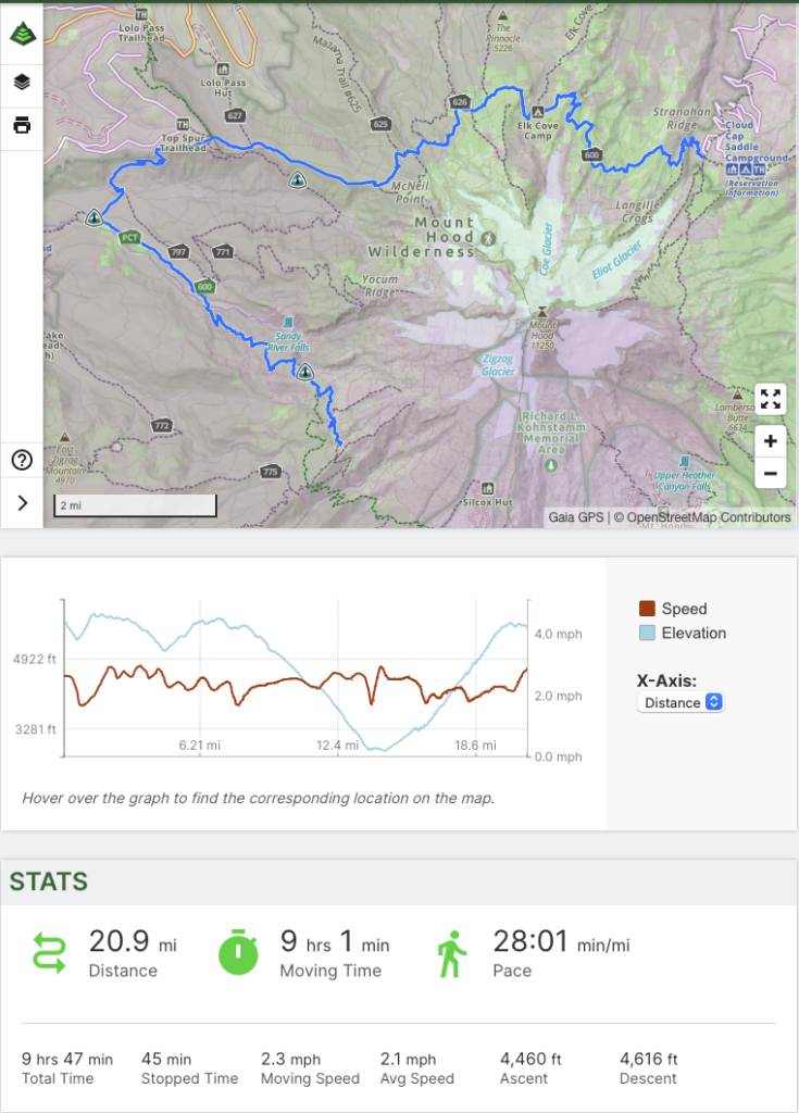
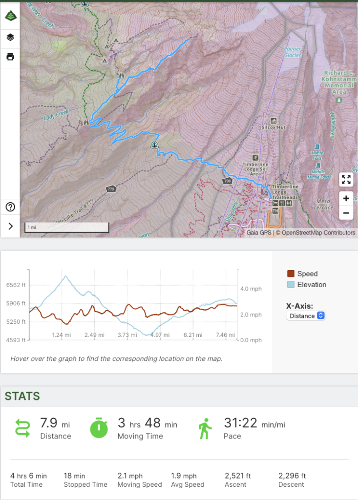
GaiaGPS Stats
Day 1
Day 2
Day 3
[…] After the 4 years, my tracks (many duplicates not shown) cover Mt Hood (Recorded tracks 1, 2, 3, 4, 5) – last year’s post and post. […]